Cox Park
Early Settlement of this Area
The Ponds Creek was originally a series of swamps and ponds draining through the Dundas Valley to join with Subiaco Creek and flow on into the Parramatta River.
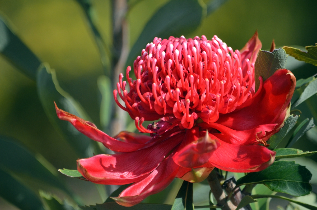
Here in the upper reaches of the catchment you are in the suburb of Telopea. The suburb’s name derives from the Waratah – Telopea speciosissima – a plant which was once abundant in the area.
One of the earliest Colonial landowners in Telopea was Thomas Arndell – the first doctor in Parramatta. He received a grant of 70 acres in 1794. In 1838, an area of 100 acres was granted to Robert Green, who established the extensive Rock Farm. After Green’s death in 1887, most of the farmland was auctioned off as large ‘villa’ sites of five to nine acres in size.
The ‘Rock Farm’ district saw further subdivision into smaller lots during the early-1900s. The district, however, remained semi-rural, predominantly featuring orchards and dairy
farms until the 1950s.
Extensive residential construction began in Telopea after the Second World War, when the Housing Commission of New South Wales began developing the Dundas Valley. A site formerly belonging to flower and seed merchants, Yates Company, was gazetted for the construction of Telopea Public School.
How wildlife is detected in Bushland and Waterways
A wide variety of animals call the bushland of the Parramatta area home. Some of them are easy to spot but many can be nocturnal, well camouflaged, or just plain shy – and require targeted investigations to identify.
One of the ways that animals are detected is through fauna surveys, carried out by experts with the appropriate accreditation and licensing to complete these studies. These surveys involve a number of physical and scientific techniques for finding evidence of the presence of specific species including insects, birds, mammals, reptiles, amphibians and fish. Camera trapping, call playback, spotlighting, ultrasonic bat detectors, catch and release, scats (animal droppings) ) and tracks identification are some of the techniques used.
Investigations like these can only be carried out under specific licences, issued by the NSW Government. Surveys are performed under special licences issued under the Biodiversity Conservation Act 2016. It is an offence to capture protected animals, even for a scientific purpose, without the appropriate licence. Penalties include significant fines and even imprisonment.
The application of eDNA testing is a newer, forensic approach to animal detection in natural areas. DNA is extracted from environmental samples like water or soil, and can be analysed in a laboratory to identify the animals that left that DNA or genetic code. This technique can be useful to identify aquatic life living in the Ponds and Subiaco waterways, particularly microscopic life that can be missed by more traditional methods.
All of the above techniques have been used to identify the animals that live in the bushland surrounding the Ponds Walk and have led to Cox Park and Galaringi Reserve being declared as Wildlife Protection Areas. This declaration means this area has been identified as being home to a large diversity of native animals. To protect these animals, cats are prohibited from these areas, and dogs must be on a leash and remain on established tracks at all times.

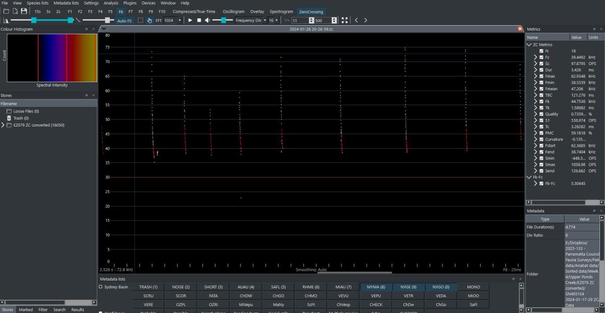
species recorded in Upper Ponds Creek in early 2024. - Image courtesy of Ecoplanning